By Larry Billinger
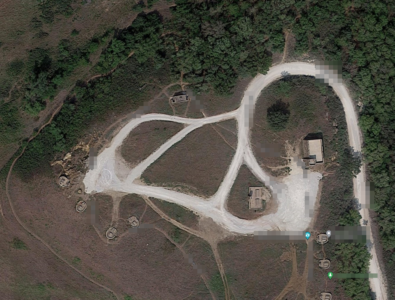
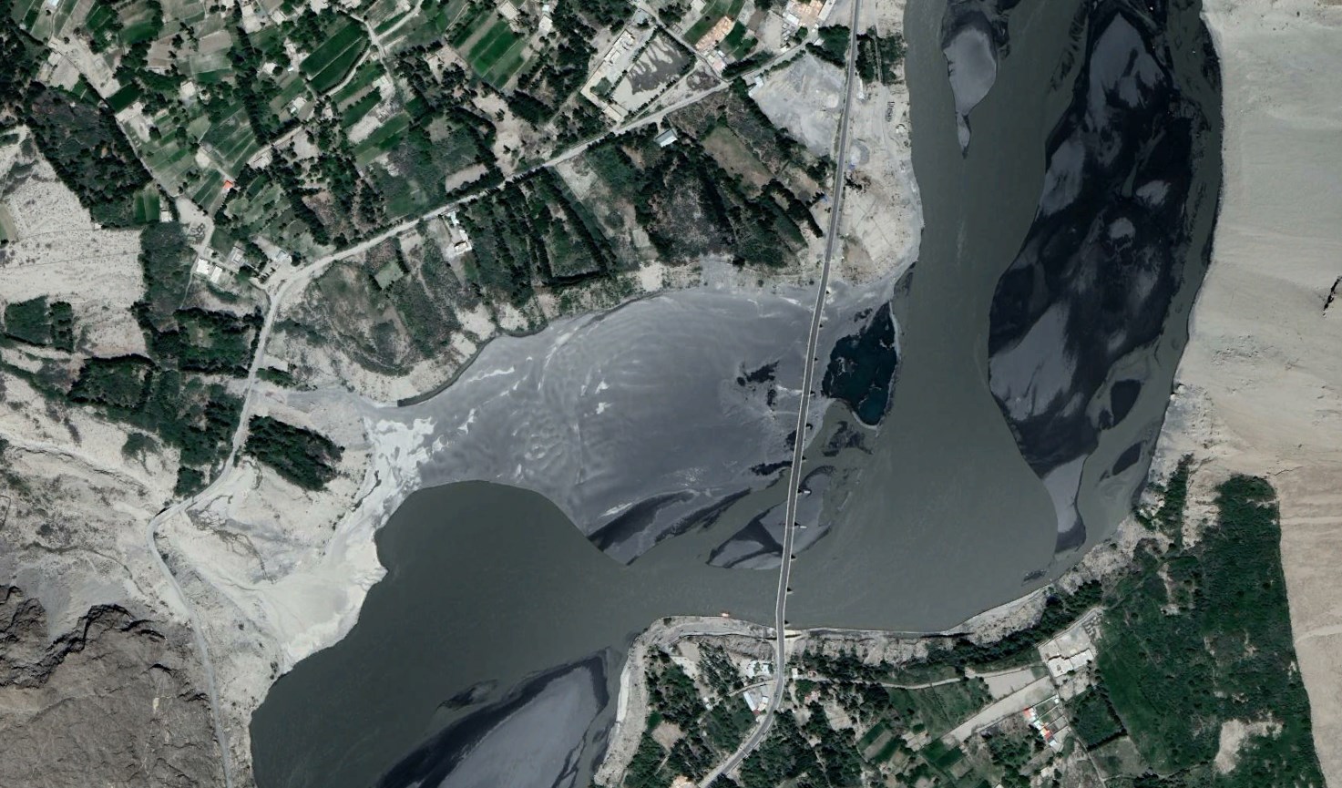
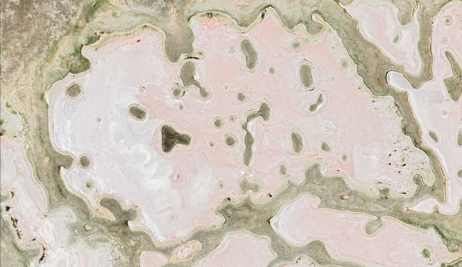
Get ready, digital adventurers! It’s time to showcase your geographical detective skills in our “Satellite Sleuths: A GPS Challenge for Glory!” As a passionate community of explorers, we bring you a unique contest that’s all about precision, speed, and bragging rights!
The Challenge:
We’re dropping a mysterious satellite image on the blog. Your task? Be the first to figure out its exact location. The stakes? Eternal glory as the reigning Satellite Sleuth!
How to Join the Hunt:
- Examine the Image: Keep an eye on the blog for the release of the satellite image.
- Identify the Coordinates: Use tools like Google Maps to decipher the precise GPS coordinates of the image’s location.
- Get the coordinates of a place
- On your computer, open Google Maps.
- Right-click the place or area on the map.
- This will open a pop-up window. You can find your latitude and longitude in decimal format at the top.
- To copy the coordinates automatically, left click on the latitude and longitude.
- Post on the Blog:
- Scroll to the comments section.
- Paste the GPS coordinates in the comment box, along with your name.
- Hit ‘Post Comment’ to enter the race!
- The Glory Awaits: The first correct post wins! We’ll announce the victor on the blog, bestowing them with the honor of being the ultimate Satellite Sleuth!
Important Rules:
- Only one entry per participant.
- Accuracy is key – ensure your coordinates is somewhere within the posted image posted here.
- Posts on Facebook or Twitter won’t count – it has to be in the blog comments.
Prize:
There’s no physical prize, but the winner will earn immense respect and glory in our community!
Are you ready to claim your fame as the master Satellite Sleuth? Stay tuned for the image drop and let the hunt begin!
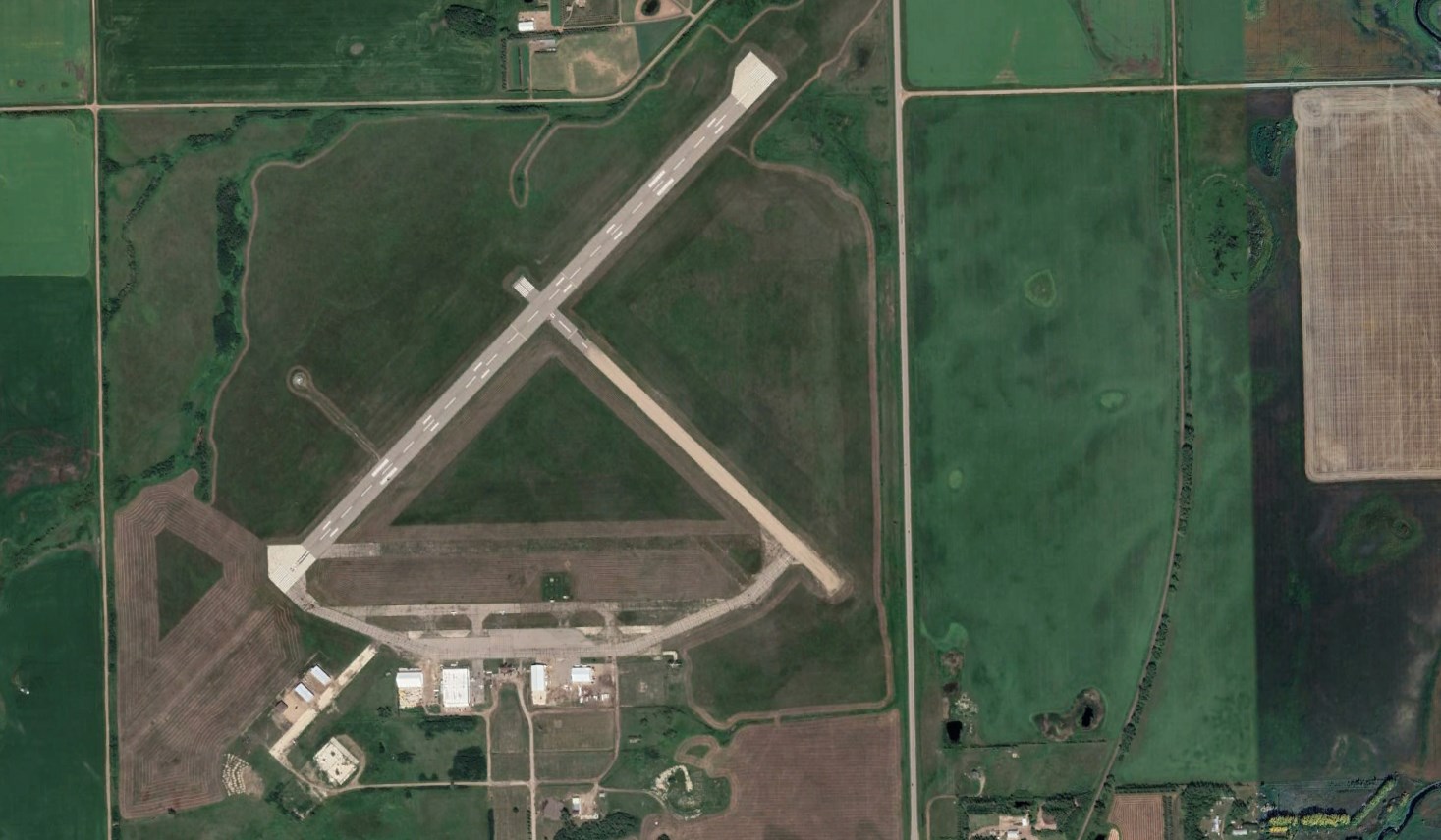
38.6131158504456, -97.70327382847172